Storbreen
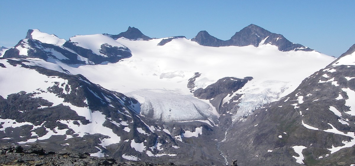
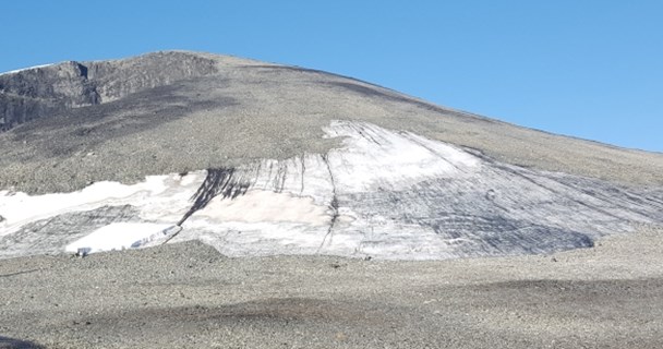
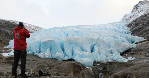
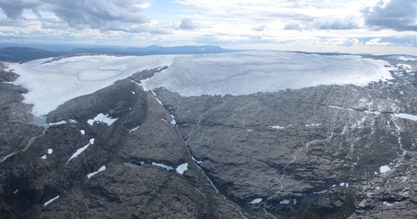
Storbreen (61°36' N, 8°8' E) (now written with an -an ending on official maps: Storbrean) is situated in the Leirdalen valley in the western part of Jotunheimen, a mountain area in southern Norway. The glacier has a total area of 4.9 km² and ranges in altitude from 1420 to 2091 m a.s.l. (map of 2019). The length of this east-facing glacier is 3 km, and it has an average slope of 14°. See photos of the glacier.
Storbreen may be characterised as a short valley glacier or a composite cirque glacier (Liestøl, 1967). A subglacial ridge divides the glacier in two rather well defined parts. The glacier has an uneven surface, indicating thin ice and undulating bottom topography. Distinct end moraines mark the post-glacial maximum of Storbreen, they reach as far as to the Leira river in the valley bottom. Storbreen probably reached its post-glacial maximum extent between 1740 and 1770 (Matthews, 1976). From its maximum extent the glacier area has decreased by 25% and the length by almost 40%.
Glaciological investigations include mass balance observations since 1949 and glacier length change measurements since 1902.The results can be viewed and downloaded from NVEs glacier data portal and are described in the series 'Glaciological Investigations in Norway'.
Mass balance
Mass balance investigations on Storbreen started in spring 1949. Storbreen has the second-longest mass balance series in the world, and is an important link in the west-east profile of mass balance investigations in southern Norway. The glacier is situated close to the main water divide and has a character of something between the maritime glaciers further west and the more continental ones in East-Jotunheimen.
Length change
Øyen established cairns to measure front fluctuations in 1902. Since 1902 the glacier has retreated more than 1.1 km.
Meterorological measurements
An automatic weather station (AWS) has been operating in the ablation zone of Storbreen since September 2001. The station was erected by the Institute of Marine and Atmospheric Research (IMAU), University of Utrecht and is operated by IMAU. The station records air temperature, wind speed, wind direction, shortwave and longwave radiation, humidity and instrument height above the surface (Giesen et al., 2009). The results from the AWS are used to monitor the local climate of Storbreen and to calibrate an energy-balance model for Storbreen (Andreassen et al., 2008; Andreassen and Oerlemans, 2009).
Topographic maps
Storbreen has been mapped in detail five times, all at the scale of 1:10 000 with 10 m contour interval (Liestøl, 1967; Andreassen, 1999). The maps were constructed from terrestrial photos taken in 1940 and 1951 and from vertical aerial photos taken in 1968, 1984 and 1997.
Other measurements
Storbreen was first described in detail by Øyen (1893), who established cairns to measure glacier length change in 1902 (Andreassen et al, 2005). Mass balance measurements were initiated in spring 1949. In addition to mass balance measurements, ice velocity and sediment load in the glacier river has been studied (Liestøl, 1967). In the 1970's and 1980's, several studies of the moraine system of Storbreen were carried out (Matthews, 1976, 2005; Erikstad and Sollid, 1986; Darmody et.al., 1987).
Literature
The report series 'Glaciological investigations in Norway' (Glasiologiske undersøkelser i Norge)
Andreassen, L.M. 1999. Comparing traditional mass balance measurements with long-term volume change extracted from topographical maps: a case study of Storbreen glacier in Jotunheimen, Norway, in the period 1940 - 1997. Geografiska Annaler, 81 A, 467-476.
Andreassen, L.M. and J. Oerlemans. 2009. Modelling long-term summer and winter balances and the climate sensitivity of Storbreen, Norway. Geografiska Annaler, 91 A (4), 233–251.
Andreassen, L.M. and G. Østrem. 1999. Storbresymposiet – 50 år med massebalansemålinger. NVE Dokument No. 5, 58 pp + app.
Andreassen, L. M., H. Elvehøy, B. Kjøllmoen, and R. V. Engeset. 2016. Reanalysis of long-term series of glaciological and geodetic mass balance for 10 Norwegian glaciers, The Cryosphere, 10, 535-552, doi:10.5194/tc-10-535-2016. (pdf)
Andreassen, L.M., F. Paul, A. Kääb and J.E. Hausberg, 2008. Landsat-derived glacier inventory for Jotunheimen, Norway, and deduced glacier changes since the 1930s. The Cryosphere, 2, 131-145. (pdf)
Andreassen, L.M., M.R. van den Broeke, R.H. Giesen and J. Oerlemans. 2008. A five-year record of surface energy and mass balance from the ablation zone of Storbreen, Norway. Journal of Glaciology, 54 (185), 245-258.
Darmody, R.G., C.E. Thorn and J.M. Rissing, 1987. Chemical weathering of fine debris from series of Holocene moraines: Storbreen, Jotunheimen, Southern Norway. Geogr. Ann., 69A 3-4: 405-413.
Erikstad, L. and Sollid, J.L., 1986. Neoglaciation in South Norway using lichenometric methods. Norsk geografisk Tidsskrift, 40, 85-105.
Giesen, R.H., L.M. Andreassen, M.R. van den Broeke and J. Oerlemans. 2009. Comparison of meteorology and surface energy balance at Storbreen, and Midtdalsbreen, two glaciers in southern Norway. The Cryosphere, 3, 57-74.
Liestøl, O. 1967. Storbreen glacier in Jotunheimen, Norway. Norsk Polarinstitutt Skrifter, 141: 63 p.
Matthews, J.A. 1976. A lichenometric test of the 1750 end-moraine hypothesis: Storbreen gletschervorfeld, southern Norway. Norsk geogr. Tids., 31: 129-136.
Matthews, J. A. 2005. “Little Ice Age” glacier variations in Jotunheimen, southern Norway: a study in regionally controlled lichenometric dating of recessional moraines with implications for climate and lichen growth rates. Holocene, 15, 1–19.