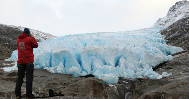
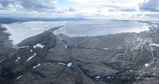
Rembesdalskåka
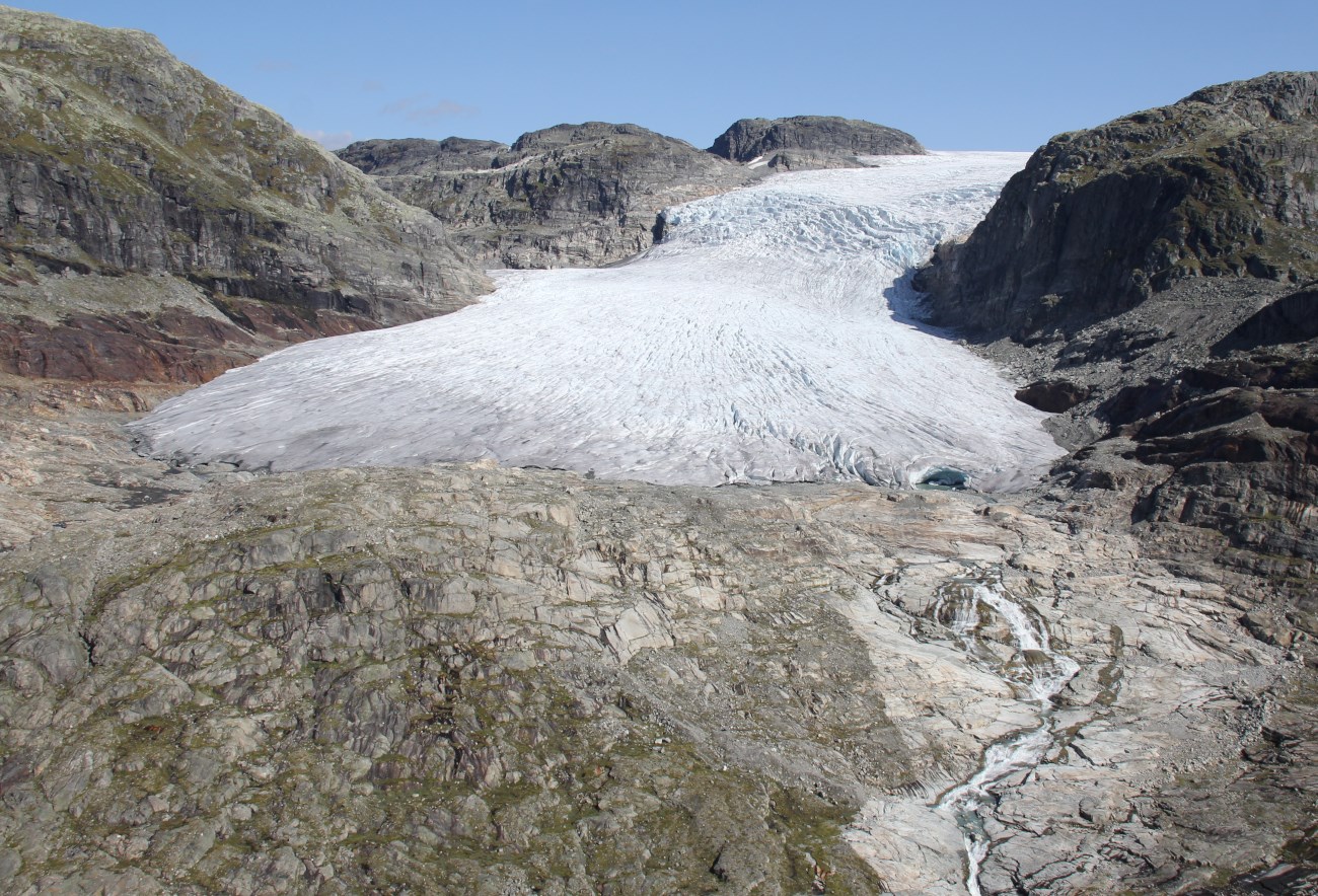
The south-west-facing Rembesdalsskåka (17 km2) is the largest outlet glacier and covers the altitude range between 1020 and 1860 m a.s.l. The glacier drains to Simadalen and Hardangerfjorden. Glaciological investigations include mass balance observations since 1963 and glacier length change measurements since 1917. The results can be viewed and downloaded from NVEs glacier data portal. The data are also published in the series 'Glaciological Investigations in Norway'. See also photos of the glacier.
Mass balance
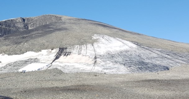
In 1963, the Norwegian Polar Institute started mass balance measurements on Rembesdalsskåka. Since 1985, the Norwegian Water Resources and Energy Directorate (NVE) has carried out the mass balance measurements. The mass balance measurements are part of the licensing terms for Sima hydro-electric power plant. During an average winter, approximately 5 m of snow accumulates on the upper part of Rembesdalskåka. The surface mass balance series from 1963 to 2014 have been reanalysed.
Glacier front variations
At the cullmination of the Little Ice Age (18th century), Rembesdalsskåka was approximately 2 km longer than today, and covered half of the lake Rembesdalsvatnet which at present is a reservoir for the Sima hydro-electric power plant. In 1917, Rekstad at Bergen Museum (later University of Bergen), initiated front variation observations. At that time, the terminus of Rembesdalsskåka was located on the up-stream shore of Rembesdalsvatnet. The glacier advanced during the 1920s, but melted back 1 km until the 1980s. The glacier advanced approximately 200 m during the 1980s and 1990s, and the advance culminated in 1997. Rembesdalsskåka has retreated since then.
Literature
The report series 'Glaciological investigations in Norway' (Glasiologiske undersøkelser i Norge)
Andreassen, L. M., H. Elvehøy, B. Kjøllmoen, and R. V. Engeset. 2016. Reanalysis of long-term series of glaciological and geodetic mass balance for 10 Norwegian glaciers, The Cryosphere, 10, 535-552, doi:10.5194/tc-10-535-2016. (pdf)
Andreassen, L.M., M. Huss, K. Melvold, H. Elvehøy and S.H. Winsvold. 2015. Ice thickness measurements and volume estimates for glaciers in Norway. Journal of Glaciology 61(228) DOI: 10.3189/2015JoG14J161
Andreassen, L.M., H. Elvehøy, and B. Kjøllmoen, 2002: Using aerial photography to study glacier changes in Norway. Annals of Glaciology 34, p 343-347.
Elvehøy, H. 1998: Samanlikning av massebalanse på Hardangerjøkulen og Folgefonna. NVE Dokument, 5-1998, 26 p. (in Norwegian)
Elvehøy H., R. Engeset, L.M. Andreassen, J. Kohler, Y. Gjessing and H. Björnson 2002: Assesment of possible jökulhlaups from Lake Demmevatnet in Norway. IAHS Publ. No 271, 31-36.
Fægri, K. 1940: Forandringer ved norske breer 1937-39. Bergen Museums Årbok 1939-40. Naturvidenskapelig rekke. Nr 3.
Giesen, R. H., L. M. Andreassen, M. R. van den Broeke and J. Oerlemans. 2009. Comparison of the meteorology and surface energy balance at Storbreen and Midtdalsbreen, two glaciers in southern Norway. The Cryosphere, 3, 57-74 (pdf)
Liestøl, O. 1956: Glacier dammed lakes in Norway, Norsk Geografisk Tidsskrift, 15(3-4), 122-149.
Rosendahl, H. 1938: Rembesdalskåki og Demmevatn på Hardangerjøkulen. Naturen, 62. årgang, 1-18. (in Norwegian)
Åkesson, H., K. Nisancioglu, R.H. Giesen, and M. Morlighem (2017). Simulating the evolution of Hardangerjøkulen ice cap in southern Norway since the mid-Holocene and its sensitivity to climate change. The Cryosphere, 11, 281–302.