Glacier data
This page gives an overview of glacier data and glacier applications provided by NVE. When using data or figures from the services, please cite them correctly, e.g. "Source: NVE". When using pictures from the services, please provide the name of the photographer, e.g. Photo: <name photographer>. For questions or comments on glacier data, please send an email to bre 'at' nve.no.
Mass balance and front variation
https://glacier.nve.no/viewer/CI/en/
View and download data and plots for selected glaciers in Norway. The data source for mass balance and length change data is NVE's database.
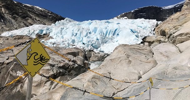
Photos of glaciers
https://glacier.nve.no/viewer/GPP/en/
View photos of selected glaciers in Norway. The earliest photos are from 1869. The number of photos, the photo angle, view and line of sight are not consistent. For each glacier it is possible to see two photos that show similar views of the glacier in different years. The source of the photos is mainly NVE's archive, with contributions from external collaborators.
Glacier lake outburst floods and glacier lake outlines
https://glacier.nve.no/viewer/GLOF/en/
Overview of registered glacier lake outburst floods in mainland Norway. Information about registered events are given as well as photos of the affected glaciers.
Data products from CryoClim and Copernicus Glacier Service Norway:
Glacier lake outline (GLO)
Download data: 2018-2019 2018 20141999-20061988-1997
Reference: When using the outlines, please refer to:
-1998/1997 & 1999/2006: Winsvold, S.H. and L.M. Andreassen.: Glacier Lake Outline – Norway, v1.0. 2012. NVE. http://arcus.nve.no/data/bre/GLO/zip/. Delivered by CryoClim service.
-2014, 2018/2019: Andreassen, L.M. (ed.), G. Moholdt, A. Kääb, A. Messerli, T. Nagy and S.H. Winsvold. 2021. Monitoring glaciers in mainland Norway and Svalbard using Sentinel. NVE Rapport 3-2021, 94 p.
-2018: Nagy, T, and L.M. Andreassen, L. M. 2019. Glacier lake outline mapping with Sentinel-2 imagery in Norway. NVE Report 40-2019, 54s.
Glacier outlines
NVE has mapped all glaciers in Norway using Landsat imagery and by digitising toographic maps. The glacier outlines can be downloaded as zipped files from our data repository at Brage:
Download data 2018-2019 (Sentinel-2) 1999-2006 (Landsat), 1988-1997 (Landsat), 1947-1985 (maps), 1895-1907 (maps).
Reference: When using the outlines, please refer to:
-Andreassen, L.M. 2022 Breer og fonner i Norge. NVE Rapport 3-2022, 48 s. (data 2018-2019)
-Andreassen et al. 2022. An inventory of Norway’s glaciers from 2018–19 Sentinel-2 data. Journal of Glaciology, https://doi.org/10.1017/jog.2022.20. (data 2018-2019)
-Andreassen, L.M., and S.H. Winsvold, S.H. (eds.). 2012. Inventory of Norwegian glaciers. NVE Rapport 38, Norges Vassdrags- og energidirektorat, 236 s. (pdf) (data 1999-2006)
-Winsvold, S.H., L.M. Andreassen and C. Kienholz. 2014. Glacier area and length changes in Norway from repeat inventories. The Cryosphere, 8, 1885-1903. (pdf) (data 1988-1997/1947-1985/1895/1907)
Glacier outlines - other glaciers - see Copernicus Glacier Service
Data from Svartisen Subglacial Laboratory
A data package of basal pressure data and other meteorological and hydrological data are available for download. Basic R-codes for preliminary analysis and presentaiton are also included in the data package. The data package can be downloaded as a zipped file here
Note that the download begins automatically when you click on the link. The files were packaged with "7zip" and must be unzipped before use. The data are available "as is". There can be errors and gaps and NVE gives no guarantee for the quality of the data or that it can give misleasding information. Take special consideration of at the R-codes given are more as a starting point and may need further work to perform satisfactorily.
When you use the data please refer and give credit to NVE: https://www.nve.no/brelaboratoriet
Glacier velocity
NVE has mapped surface velocities using optical imagery from Sentinel-2 for glaciers in Norway.
The glacier velocity dataset v2.0 gives velocity data for glaciers in mainland Norway for 2015-2018. A first dataset v1.0 gives velocity data for Nigardsbreen, Tunsbergdalsbreen, Engabreen and Rembesdalskåka.
Download velocity data as a zipped file:
NVE 2019. Glacier velocity data. version 2.0. Copernicus Glacier Service/Copernicus bretjeneste. Norwegian Water Resources and Energy Directorate, Oslo, Norway.
NVE 2019. Glacier velocity data. version 1.0. Copernicus Glacier Service/Copernicus bretjeneste. Norwegian Water Resources and Energy Directorate, Oslo, Norway.
See also more information and further references on glacier velocity in theCopernicus Glacier Service project.
Ice thickness data
Since the 1980s, ice thickness measurements have been carried out by radioecho sounding on many glaciers in Norway. An overiew of the measurements is given in the scientific paper 'Ice thickness measurements and volume estimates for glaciers in Norway. Journal of Glaciology 61(228) DOI: 10.3189/2015JoG14J161'.
Some of the data can be viewed in NVEs breatlas. (zoom in on a region, choose Kartlag (map layer) and tick Istykkelse (ice thickness). This point thickness dataset is available for download.
Download ice thickness data as a zipped file:
NVE, 2018. Ice thickness data. Version 2.0. Norwegian Water Resources and Energy Directorate, Oslo, Norway.
The applications listed here are developed by NVE as part of the CryoClim project. Glacier velocity data are derived in the Copernicus Glacier Service project. For questions or photo requests please contact NVE by sending an email to bre 'at' nve.no.